European Ground Motion Service – Data visualization
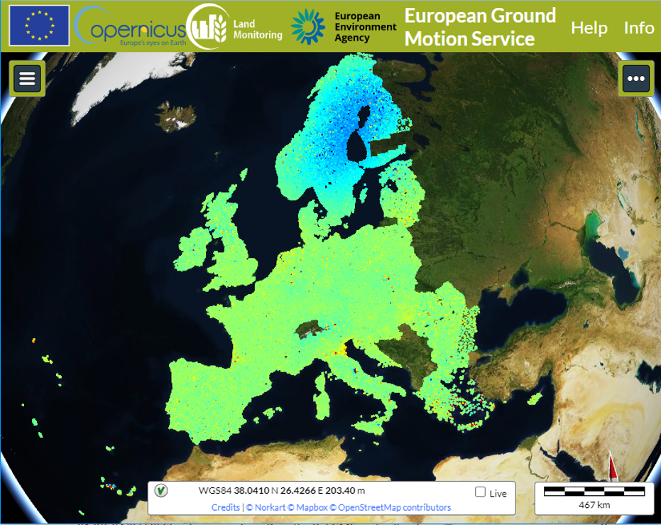
Today Copernicus released an updated version of European Ground Motion Service, through the viewer platform: https://egms.land.copernicus.eu/.
European Ground Motion Service (EGMS) is a new service offered completely free of charge by Copernicus, and included among Land Monitoring Services.
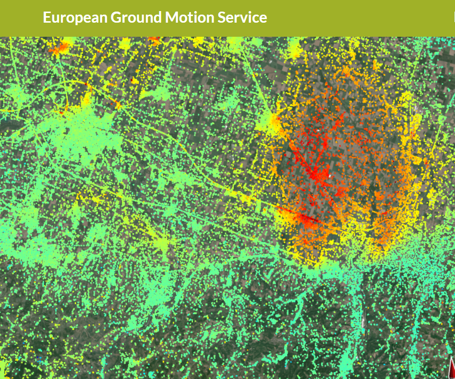
The service focuses on providing information regarding the motion of land, structures, and infrastructure across all Europe. EGMS products are maps colour-coded by the velocity of ground motion, in terms of millimeters per year. The products are obtained from multitemporal, harmonized, and quality controlled interferometric analysis of Sentinel-1 images, starting from February 2015.
The project started in 2019, when European Environment Agency (EEA) entrusted a consortium of companies with the task to produce EGMS Products. NHAZCA is working with the consortium to support validation and dissemination activities.
EGMS represents a fundamental knowledge base that will increase users’ understanding of ground motion events and support sustainable choices in managing properly the territory and its resources.
At the moment two different kinds of EGMS products can be explored in the viewer platform, which requires no registration: ORTHO products (vertical displacements and horizontal displacements) and CALIBRATED products (ascending and descending orbits)-
For now, data can only be visualized and explored. Check the EGMS web site for any news about the next releases!
EGMS is a project funded by the European Environment Agency (EEA), as part of the COPERNICUS Land Monitoring Service (CLMS). The EGMS products are supplied by the ORIGINAL Consortium, comprising e-GEOS, TRE Altamira, NORCE and GAF, with the collaboration of NHAZCA, Earth Metrics, Geological Survey of Norway (NGU), PPO.labs, Satellite Geodetic Observatory (SGO) and DLR.